

Teocaltitan is a small archaeological site in the state of Jalisco about an hour from Guadalajara.
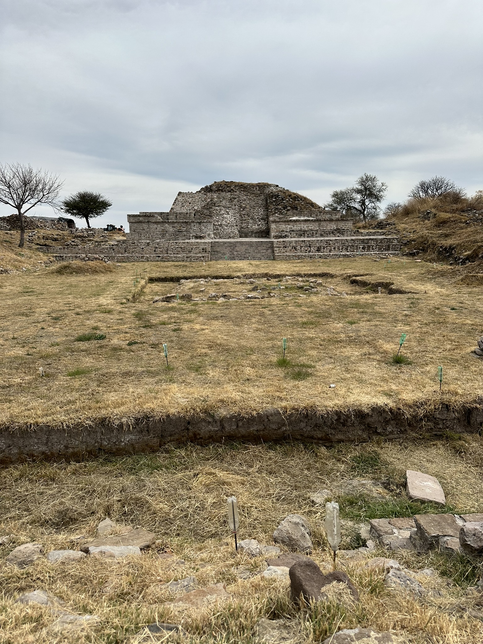
On the way from San Luis Potosi to our house in Magdalena in Jalisco, we stopped at the archaeological site of Teocaltitan. I had found a little information on the site on the internet and I’m always looking for something archaeology related on our trips, so this seemed perfect. From what I read on the internet, Teocaltitan is a ceremonial center belonging to the Grillo Tradition. There are several pyramids and a ball court at the site which date between 450-900 AD. Then 100 years later the site was occupied again but was abandoned by 1350 AD. 23 structures have been identified so far all of which are located at the top of a hill. This site predates Guachimontones, which is another pre-Hispanic site in the state of Jalisco, having circular pyramids.
We followed Google Maps to get there. It took us off the cuota onto a one lane dirt road to the town of Teocaltitan and did take us to the bottom of the hill where the site was located, but we ended up in someone’s yard. They were outside and told us we could either park at the locked gate we saw back a couple of hundred yards and walk up or drive around to a chapel and drive up. We didn’t really know how to find the chapel so we opted to park and walked up. Once you arrived near the site, there were bathrooms and a set of stone stairs leading up to the top. It probably took us 15 minutes to walk up from the Jeep. The altitude here is about 4500 feet so we were huffing and puffing while Carlos ran ahead with no problem.
Teocaltitan is a ceremonial center belonging to the Grillo Tradition. There are several pyramids and a ball court at the site which date between 450-900 AD. 100 years later the site was occupied again but was abandoned by 1350 AD. 23 structures have been identified so far all of which are located at the top of a hill.
At the top, the path opens to the main pyramid that has been somewhat restored and there was an archaeologist and several dogs who stay on site. He was quite informative but only spoke Spanish so I didn’t catch everything. He told us that someone stays on site 24 hours a day to protect the site and walked us around and showed us different areas.
When we left we, Google gave us different directions that did not involve a dirt road, which made Luigi way happier. I’m adding these directions at the bottom of the page.

Here are three takeaways:
- Small remote site: There was no signage and no entrance fees. The archaeologist on site said the last visitors had been 3 months prior. There were 2 other people there when we visited.
- Google Maps doesn’t give correct information: Google maps will get you close but you may need to ask directions once you arrive in the town.
- Walking is involved: If you drive all the way to the site, you still must walk up a series of steps and some dirt paths to get to the actual pyramid.
Driving Directions
From Guadalajara (approximately 1 3/4 hours):
Take the cuota 80D. Exit at the Caseta de Cobro Jalostotitlan then turn left onto Cam. A Teocaltitan de Guadalupe. This will take you into the town of Teocaltitan. We followed the Google Maps and parked and walked up the hill. However to drive up to the site, you should take 16 de Septiembre and turn left of Hidalgo. That road ends at Santuario De Nuestra Sra. De Guadalupe. Turn right there and the dirt road should take you up the hill. When you see the a stairway leading up to the left and a small set of bathrooms, you have arrived. There is no signage.
Janie Acosta